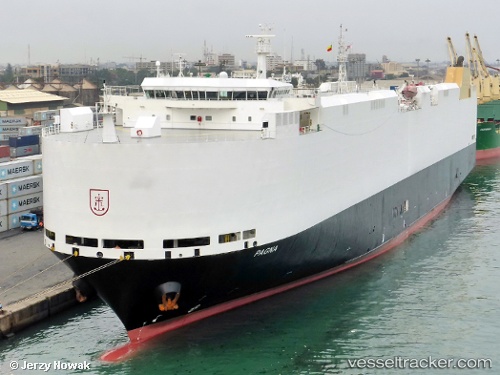
 PAGNA
PAGNA
Current Status
Where is the vessel?
PAGNA is currently in 20 nm SW of Dai Hung (STS Load), based on AIS data received about 14h ago.
Latest AIS update:
Current position: 8.69500° N, 103.00667° E (20 nm SW of Dai Hung (STS Load))
Average speed (last 7 days): Loading…
Average speed (last 30 days): Loading…
Vessel profile: PAGNA is a Vehicles Carrier with dimensions m x m.
This page combines live AIS, route history, probable destination signals, nearby traffic, and port activity for practical vessel monitoring.
The current position of vessel PAGNA is 8.69500 lat / 103.00667 lng. Updated: 2026-05-18 19:42:24 UTCNearest reference points:
- 46 nm W of Dai Hung (STS Load)
- 30 nm E of Dai Hung (STS Load)
- 45 nm NW of Muda Marine Terminal
Currently sailing under the flag of Marshall Islands ![]()
Details:
Live Vessel PAGNA Analytics (details, animations, etc.)
Recent AIS points (UTC):
2026-05-18 15:47:51 UTC · 7.98833, 103.27333 · SOG 12 kn · COG -1°2026-05-18 18:12:11 UTC · 8.42666, 103.09833 · SOG 11 kn · COG -1°
2026-05-18 19:42:24 UTC · 8.69500, 103.00667 · SOG 11 kn · COG -1°
2026-05-18 19:42:24 UTC · 8.69500, 103.00667 · SOG 11 kn · COG -1°