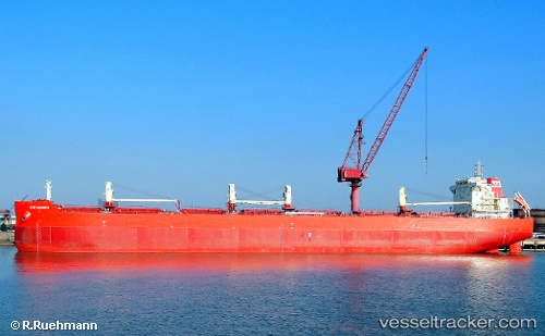
 KUBRAT
Current Status
Where is the vessel?
KUBRAT is currently in 40 nm SE of Reinhardtsdorf-Schöna, based on AIS data received about 14h ago.
Latest AIS update:
Current position: 13.86243° N, 51.46549° E (40 nm SE of Reinhardtsdorf-Schöna)
Average speed (last 7 days): Loading…
Average speed (last 30 days): Loading…
Vessel profile: KUBRAT is a Bulk Carrier with dimensions m x m.
This page combines live AIS, route history, probable destination signals, nearby traffic, and port activity for practical vessel monitoring.
The current position of vessel KUBRAT is 13.86243 lat / 51.46549 lng. Updated: 2026-05-19 01:18:46 UTCNearest reference points:
- 110 nm NE of Gross Koris
- 106 nm S of Port Raysut
Currently sailing under the flag of Marshall Islands ![]()
Details:
Live Vessel KUBRAT Analytics (details, animations, etc.)
Recent AIS points (UTC):
2026-05-18 22:00:13 UTC · 13.69600, 50.91886 · SOG 9.8 kn · COG 80°2026-05-18 22:30:55 UTC · 13.72132, 51.00143 · SOG 9.9 kn · COG 78°
2026-05-18 23:42:50 UTC · 13.78403, 51.19688 · SOG 10.2 kn · COG 74°
2026-05-19 01:18:46 UTC · 13.86243, 51.46549 · SOG 10.2 kn · COG 74°