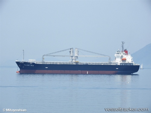
 Pulang Tala
Current Status
Where is the vessel?
Pulang Tala is currently in Near Kinuura, based on AIS data received about 14h ago.
Latest AIS update:
Current position: 34.87158° N, 136.95909° E (Near Kinuura)
Average speed (last 7 days): Loading…
Average speed (last 30 days): Loading…
Vessel profile: Pulang Tala is a General Cargo Ship with dimensions 124m x 23m.
This page combines live AIS, route history, probable destination signals, nearby traffic, and port activity for practical vessel monitoring.
The current position of vessel Pulang Tala is 34.87158 lat / 136.95909 lng. Updated: 2026-05-22 16:14:07 UTCNearest reference points:
- Near Kinuura
- Near Mihama
- Near Nagoya
Currently sailing under the flag of Philippines ![]()
Details:
Live Vessel Pulang Tala Analytics (details, animations, etc.)
Recent AIS points (UTC):
2026-05-22 12:08:08 UTC · 34.87156, 136.95911 · SOG 0 kn · COG 11°2026-05-22 13:50:07 UTC · 34.87163, 136.95915 · SOG 0 kn · COG 11°
2026-05-22 14:14:11 UTC · 34.87157, 136.95911 · SOG 0 kn · COG 11°
2026-05-22 16:14:07 UTC · 34.87158, 136.95909 · SOG 0 kn · COG 11°