 Alianca Manaus
Current Status
Where is the vessel?
Alianca Manaus is currently in 251 nm N of Anse Kerlan, based on AIS data received about 15h ago.
Latest AIS update:
Current position: 0.17167° S, 56.31500° E (251 nm N of Anse Kerlan)
Average speed (last 7 days): Loading…
Average speed (last 30 days): Loading…
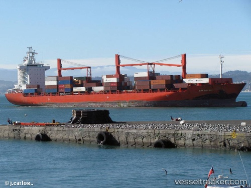
Vessel profile: Alianca Manaus is a Container Ship with dimensions 208m x 30m.
This page combines live AIS, route history, probable destination signals, nearby traffic, and port activity for practical vessel monitoring.
The current position of vessel Alianca Manaus is -0.17167 lat / 56.31500 lng. Updated: 2026-05-21 17:36:16 UTCNearest reference points:
- Open sea, approx. 401 nm off the nearest listed port
- Open sea, approx. 402 nm off the nearest listed port
- Open sea, approx. 400 nm off the nearest listed port
Currently sailing under the flag of Singapore ![]()
Alianca Manaus built in 2004 year
Deadweight:
33925 tDetails:
Live Vessel Alianca Manaus Analytics (details, animations, etc.)
Recent AIS points (UTC):
2026-05-21 13:42:11 UTC · 0.55500, 56.88167 · SOG 14 kn · COG -1°2026-05-21 15:24:19 UTC · 0.24167, 56.62500 · SOG 14 kn · COG -1°
2026-05-21 15:57:17 UTC · 0.14167, 56.54333 · SOG 14 kn · COG -1°
2026-05-21 17:36:16 UTC · -0.17167, 56.31500 · SOG 14 kn · COG -1°