 PM DUKE
Current Status
Where is the vessel?
PM DUKE is currently in 95 nm W of Honawar, based on AIS data received about 14h ago.
Latest AIS update:
Current position: 13.85833° N, 72.86167° E (95 nm W of Honawar)
Average speed (last 7 days): Loading…
Average speed (last 30 days): Loading…
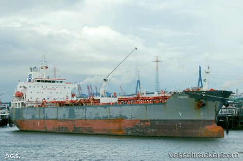
Vessel profile: PM DUKE is a Oil/Chemical Tanker with dimensions m x m.
This page combines live AIS, route history, probable destination signals, nearby traffic, and port activity for practical vessel monitoring.
The current position of vessel PM DUKE is 13.85833 lat / 72.86167 lng. Updated: 2026-05-20 11:01:39 UTCNearest reference points:
- 89 nm W of Marmagao (Marmugao)
- 57 nm NW of New Mangalore
- 17 nm NW of Panamburu
Currently sailing under the flag of Singapore ![]()
Details:
Live Vessel PM DUKE Analytics (details, animations, etc.)
Recent AIS points (UTC):
2026-05-20 06:46:45 UTC · 14.61500, 72.43333 · SOG 12 kn · COG -1°2026-05-20 06:46:45 UTC · 14.61500, 72.43333 · SOG 12 kn · COG -1°
2026-05-20 10:13:42 UTC · 14.00333, 72.78833 · SOG 12 kn · COG -1°
2026-05-20 11:01:39 UTC · 13.85833, 72.86167 · SOG 12 kn · COG -1°