Phu An 368
Current StatusWhere is the vessel?
Phu An 368 is currently in 110 nm NE of Colomadu, based on AIS data received about 15h ago.
Latest AIS update:
Current position: 8.74418° N, 112.14388° E (110 nm NE of Colomadu)
Average speed (last 7 days): Loading…
Average speed (last 30 days): Loading…
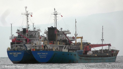
Vessel profile: Phu An 368 is a General Cargo Ship with dimensions 15m x 92m.
This page combines live AIS, route history, probable destination signals, nearby traffic, and port activity for practical vessel monitoring.
The current position of vessel Phu An 368 is 8.74418 lat / 112.14388 lng. Updated: 2026-05-21 18:57:06 UTCNearest reference points:
- 142 nm N of Pulau Lang Lang
- 141 nm N of Pulau Lang Lang
- 156 nm SE of Phan Rang-Tháp Chàm
Details:
Live Vessel Phu An 368 Analytics (details, animations, etc.)
Recent AIS points (UTC):
2026-05-21 15:44:18 UTC · 8.66763, 112.62941 · SOG 9 kn · COG -1°2026-05-21 17:33:35 UTC · 8.71130, 112.35267 · SOG 9 kn · COG -1°
2026-05-21 18:57:06 UTC · 8.74418, 112.14388 · SOG 9 kn · COG -1°
2026-05-21 18:57:06 UTC · 8.74418, 112.14388 · SOG 9 kn · COG -1°