 INA
INA
Current Status
Where is the vessel?
INA is currently in 128 nm NE of Pinelands, based on AIS data received about 14h ago.
Latest AIS update:
Current position: 34.74554° N, 20.88415° E (128 nm NE of Pinelands)
Average speed (last 7 days): Loading…
Average speed (last 30 days): Loading…
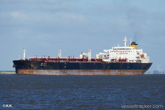
Vessel profile: INA is a Crude Oil Tanker with dimensions m x m.
This page combines live AIS, route history, probable destination signals, nearby traffic, and port activity for practical vessel monitoring.
The current position of vessel INA is 34.74554 lat / 20.88415 lng. Updated: 2026-05-19 06:59:27 UTCNearest reference points:
- 85 nm W of Paleochora
- 61 nm N of Al Marj
- 59 nm W of Paleochora
Currently sailing under the flag of Cameroon ![]()
Details:
Live Vessel INA Analytics (details, animations, etc.)
Recent AIS points (UTC):
2026-05-19 03:40:19 UTC · 34.93258, 20.07793 · SOG 12.4 kn · COG 105°2026-05-19 04:17:06 UTC · 34.89838, 20.22670 · SOG 12.5 kn · COG -1°
2026-05-19 05:43:38 UTC · 34.81649, 20.57724 · SOG 12.4 kn · COG 105°
2026-05-19 06:59:27 UTC · 34.74554, 20.88415 · SOG 12.4 kn · COG 104°