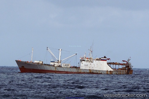
 ZEELAND
Current Status
Where is the vessel?
ZEELAND is currently in 17 nm SE of Wan Tsai, based on AIS data received about 14h ago.
Latest AIS update:
Current position: 22.00333° N, 114.49333° E (17 nm SE of Wan Tsai)
Average speed (last 7 days): Loading…
Average speed (last 30 days): Loading…
Vessel profile: ZEELAND is a Fishing Vessel with dimensions 93.9m x 15m.
This page combines live AIS, route history, probable destination signals, nearby traffic, and port activity for practical vessel monitoring.
The current position of vessel ZEELAND is 22.00333 lat / 114.49333 lng. Updated: 2026-05-20 19:09:09 UTCNearest reference points:
- 25 nm SE of Wan Tsai
- 22 nm E of Wan Tsai
- 13 nm E of Wong Chuk Hang
Currently sailing under the flag of Cameroon ![]()
ZEELAND built in 1984 year
Deadweight:
2590 tDetails:
Live Vessel ZEELAND Analytics (details, animations, etc.)
Recent AIS points (UTC):
2026-05-20 15:56:48 UTC · 22.00373, 114.49377 · SOG 0.1 kn · COG 182°2026-05-20 16:35:51 UTC · 22.00375, 114.49381 · SOG 0 kn · COG 181°
2026-05-20 17:38:50 UTC · 22.00379, 114.49389 · SOG 0.5 kn · COG 183°
2026-05-20 19:09:09 UTC · 22.00333, 114.49333 · SOG 0 kn · COG -1°