 vesseltracker.com
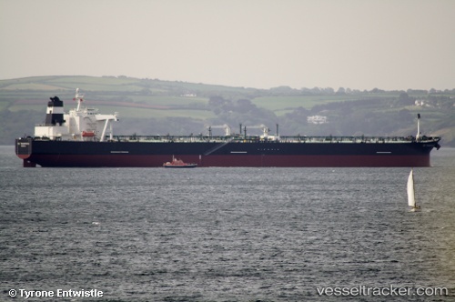
 RIGEL
RIGEL
Current Status
Where is the vessel?
RIGEL is currently in 206 nm SE of Masirah, based on AIS data received about 16h ago.
Latest AIS update:
Current position: 17.74487° N, 61.10743° E (206 nm SE of Masirah)
Average speed (last 7 days): Loading…
Average speed (last 30 days): Loading…
Vessel profile: RIGEL is a Crude Oil Tanker with dimensions m x m.
This page combines live AIS, route history, probable destination signals, nearby traffic, and port activity for practical vessel monitoring.
The current position of vessel RIGEL is 17.74487 lat / 61.10743 lng. Updated: 2026-05-17 22:26:27 UTCNearest reference points:
- Open sea, approx. 400 nm off the nearest listed port
- Open sea, approx. 402 nm off the nearest listed port
- Open sea, approx. 404 nm off the nearest listed port
Currently sailing under the flag of Cameroon ![]()
Details:
Live Vessel RIGEL Analytics (details, animations, etc.)
Recent AIS points (UTC):
2026-05-17 22:26:27 UTC · 17.74487, 61.10743 · SOG 13.5 kn · COG 306°2026-05-17 22:26:27 UTC · 17.74487, 61.10743 · SOG 13.5 kn · COG 306°
2026-05-17 22:26:27 UTC · 17.74487, 61.10743 · SOG 13.5 kn · COG 306°
2026-05-17 22:26:27 UTC · 17.74487, 61.10743 · SOG 13.5 kn · COG 306°