 DIVIT
DIVIT
Current Status
Where is the vessel?
DIVIT is currently in 62 nm E of Xijiang, based on AIS data received about 14h ago.
Latest AIS update:
Current position: 21.40500° N, 115.96500° E (62 nm E of Xijiang)
Average speed (last 7 days): Loading…
Average speed (last 30 days): Loading…
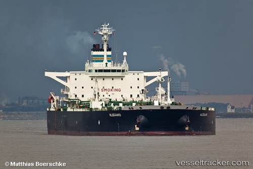
Vessel profile: DIVIT is a Crude Oil Tanker with dimensions m x m.
This page combines live AIS, route history, probable destination signals, nearby traffic, and port activity for practical vessel monitoring.
The current position of vessel DIVIT is 21.40500 lat / 115.96500 lng. Updated: 2026-05-20 03:41:31 UTCNearest reference points:
- 49 nm S of SHANWEI
- 53 nm S of Jiazi
- 64 nm SE of Jiazi
Currently sailing under the flag of Comoros ![]()
Details:
Live Vessel DIVIT Analytics (details, animations, etc.)
Recent AIS points (UTC):
2026-05-19 23:54:48 UTC · 21.46167, 115.33333 · SOG 9 kn · COG -1°2026-05-20 02:04:15 UTC · 21.41299, 115.69602 · SOG 9.3 kn · COG 107°
2026-05-20 02:04:15 UTC · 21.41299, 115.69602 · SOG 9.3 kn · COG 107°
2026-05-20 03:41:31 UTC · 21.40500, 115.96500 · SOG 9 kn · COG -1°