 PHOENIX E
Current Status
Where is the vessel?
PHOENIX E is currently in 14 nm NE of Il-Kappara, based on AIS data received about 15h ago.
Latest AIS update:
Current position: 35.94573° N, 14.83290° E (14 nm NE of Il-Kappara)
Average speed (last 7 days): Loading…
Average speed (last 30 days): Loading…
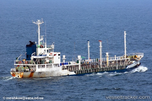
Vessel profile: PHOENIX E is a Chemical Tanker with dimensions m x m.
This page combines live AIS, route history, probable destination signals, nearby traffic, and port activity for practical vessel monitoring.
The current position of vessel PHOENIX E is 35.94573 lat / 14.83290 lng. Updated: 2026-05-21 11:35:00 UTCNearest reference points:
- 13 nm E of Il-Kappara
- 18 nm E of Il-Kappara
- Near Xghajra
Currently sailing under the flag of Comoros ![]()
Details:
Live Vessel PHOENIX E Analytics (details, animations, etc.)
Recent AIS points (UTC):
2026-05-21 07:47:02 UTC · 35.94576, 14.83340 · SOG 0.5 kn · COG -1°2026-05-21 09:46:59 UTC · 35.94572, 14.83320 · SOG 0 kn · COG -1°
2026-05-21 11:02:00 UTC · 35.94569, 14.83301 · SOG 0.3 kn · COG -1°
2026-05-21 11:35:00 UTC · 35.94573, 14.83290 · SOG 0 kn · COG -1°