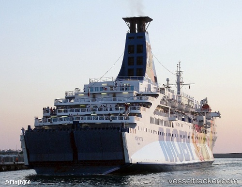
 ELPIS
ELPIS
Current Status
Where is the vessel?
ELPIS is currently in Near Penang, based on AIS data received about 15h ago.
Latest AIS update:
Current position: 5.41896° N, 100.34659° E (Near Penang)
Average speed (last 7 days): Loading…
Average speed (last 30 days): Loading…
Vessel profile: ELPIS is a Ro-Ro/Passenger Ship with dimensions m x m.
This page combines live AIS, route history, probable destination signals, nearby traffic, and port activity for practical vessel monitoring.
The current position of vessel ELPIS is 5.41896 lat / 100.34659 lng. Updated: 2026-05-19 11:38:15 UTCNearest reference points:
- Near Mak Mandin
- Near Pulau Tikus
- Near Perai
Currently sailing under the flag of Comoros ![]()
Details:
Live Vessel ELPIS Analytics (details, animations, etc.)
Recent AIS points (UTC):
2026-05-19 07:34:16 UTC · 5.55879, 100.16771 · SOG 1.6 kn · COG 263°2026-05-19 10:22:35 UTC · 5.42055, 100.34767 · SOG 2.3 kn · COG 187°
2026-05-19 11:05:13 UTC · 5.41896, 100.34657 · SOG 0 kn · COG 174°
2026-05-19 11:38:15 UTC · 5.41896, 100.34659 · SOG 0 kn · COG 174°