 vesseltracker.com
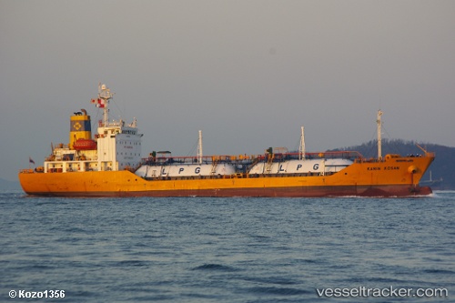
 MAYA GAS 1
Current Status
Where is the vessel?
MAYA GAS 1 is currently in 16 nm E of UMM QASR, based on AIS data received about 14h ago.
Latest AIS update:
Current position: 29.96557° N, 48.24599° E (16 nm E of UMM QASR)
Average speed (last 7 days): Loading…
Average speed (last 30 days): Loading…
Vessel profile: MAYA GAS 1 is a Tanker with dimensions m x m.
This page combines live AIS, route history, probable destination signals, nearby traffic, and port activity for practical vessel monitoring.
The current position of vessel MAYA GAS 1 is 29.96557 lat / 48.24599 lng. Updated: 2026-05-18 10:24:16 UTCNearest reference points:
- Near Abadan
- Near KHOR AL ZUBAIR
- 11 nm SW of Basrah Oil Terminal
Currently sailing under the flag of Comoros ![]()
Details:
Live Vessel MAYA GAS 1 Analytics (details, animations, etc.)
Recent AIS points (UTC):
2026-05-18 07:13:25 UTC · 29.66842, 48.72701 · SOG 8 kn · COG 315°2026-05-18 08:07:34 UTC · 29.74137, 48.61479 · SOG 11.5 kn · COG 301°
2026-05-18 10:01:25 UTC · 29.91727, 48.29752 · SOG 11.5 kn · COG 317°
2026-05-18 10:24:16 UTC · 29.96557, 48.24599 · SOG 11.5 kn · COG 317°