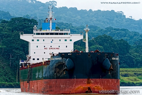
 Indian Harmony
Current Status
Where is the vessel?
Indian Harmony is currently in 112 nm NE of PANGKAL BALAM, based on AIS data received about 17h ago.
Latest AIS update:
Current position: 0.39132° S, 106.89446° E (112 nm NE of PANGKAL BALAM)
Average speed (last 7 days): Loading…
Average speed (last 30 days): Loading…
Vessel profile: Indian Harmony is a Bulk Carrier with dimensions 225m x 32m.
This page combines live AIS, route history, probable destination signals, nearby traffic, and port activity for practical vessel monitoring.
The current position of vessel Indian Harmony is -0.39132 lat / 106.89446 lng. Updated: 2026-05-23 04:22:05 UTCNearest reference points:
- 69 nm NE of Exspan
- 46 nm NW of Tanjung Pandan
- Near PANGKAL BALAM
Currently sailing under the flag of Liberia ![]()
Indian Harmony built in 2013 year
Deadweight:
76000 tDetails:
Live Vessel Indian Harmony Analytics (details, animations, etc.)
Recent AIS points (UTC):
2026-05-23 04:22:05 UTC · -0.39132, 106.89446 · SOG 12.1 kn · COG -1°2026-05-23 04:22:05 UTC · -0.39132, 106.89446 · SOG 12.1 kn · COG -1°
2026-05-23 04:22:05 UTC · -0.39132, 106.89446 · SOG 12.1 kn · COG -1°
2026-05-23 04:22:05 UTC · -0.39132, 106.89446 · SOG 12.1 kn · COG -1°