 CAPE KORI
Current Status
Where is the vessel?
CAPE KORI is currently in 66 nm SE of Vinh Cam Ranh, based on AIS data received about 15h ago.
Latest AIS update:
Current position: 11.36231° N, 110.13478° E (66 nm SE of Vinh Cam Ranh)
Average speed (last 7 days): Loading…
Average speed (last 30 days): Loading…
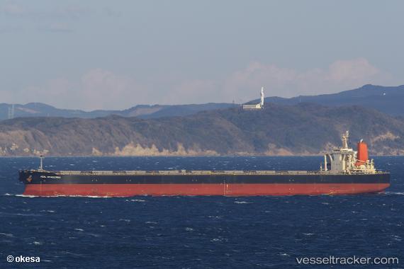
Vessel profile: CAPE KORI is a Bulk Carrier with dimensions 300m x 300m.
This page combines live AIS, route history, probable destination signals, nearby traffic, and port activity for practical vessel monitoring.
The current position of vessel CAPE KORI is 11.36231 lat / 110.13478 lng. Updated: 2026-05-22 15:56:51 UTCNearest reference points:
- Near Vinh Cam Ranh
- 156 nm SE of Phan Rang-Tháp Chàm
- 163 nm E of Vinh Cam Ranh
Currently sailing under the flag of Liberia ![]()
CAPE KORI built in 2004 year
Deadweight:
203277 tDetails:
Live Vessel CAPE KORI Analytics (details, animations, etc.)
Recent AIS points (UTC):
2026-05-22 13:00:15 UTC · 10.88133, 110.08411 · SOG 9.8 kn · COG -1°2026-05-22 13:45:25 UTC · 10.99919, 110.12628 · SOG 9.8 kn · COG -1°
2026-05-22 15:56:51 UTC · 11.36231, 110.13478 · SOG 10.7 kn · COG 339°
2026-05-22 15:56:51 UTC · 11.36231, 110.13478 · SOG 10.7 kn · COG 339°