 CECELA S
Current Status
Where is the vessel?
CECELA S is currently in Near Withernsea, based on AIS data received about 14h ago.
Latest AIS update:
Current position: 53.66114° N, 0.37512° E (Near Withernsea)
Average speed (last 7 days): Loading…
Average speed (last 30 days): Loading…
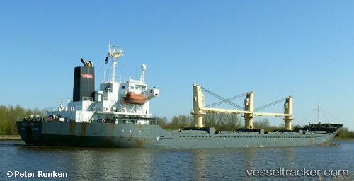
Vessel profile: CECELA S is a Bulk Carrier with dimensions m x m.
This page combines live AIS, route history, probable destination signals, nearby traffic, and port activity for practical vessel monitoring.
The current position of vessel CECELA S is 53.66114 lat / 0.37512 lng. Updated: 2026-05-21 17:06:20 UTCNearest reference points:
- Near Withernsea
- 14 nm E of Withernsea
- Near Grimsby
Currently sailing under the flag of Liberia ![]()
Details:
Live Vessel CECELA S Analytics (details, animations, etc.)
Recent AIS points (UTC):
2026-05-21 13:33:13 UTC · 53.75693, 0.47817 · SOG 0.1 kn · COG -1°2026-05-21 14:01:18 UTC · 53.75699, 0.47832 · SOG 0.1 kn · COG -1°
2026-05-21 15:56:06 UTC · 53.75599, 0.48034 · SOG 0.8 kn · COG 144°
2026-05-21 17:06:20 UTC · 53.66114, 0.37512 · SOG 6.5 kn · COG 207°