 WANEN
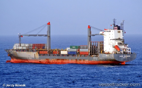
WANEN
Current Status
Where is the vessel?
WANEN is currently in Near BUKOM ISLAND, based on AIS data received about 14h ago.
Latest AIS update:
Current position: 1.24453° N, 103.74784° E (Near BUKOM ISLAND)
Average speed (last 7 days): Loading…
Average speed (last 30 days): Loading…
Vessel profile: WANEN is a Container Ship with dimensions m x m.
This page combines live AIS, route history, probable destination signals, nearby traffic, and port activity for practical vessel monitoring.
The current position of vessel WANEN is 1.24453 lat / 103.74784 lng. Updated: 2026-05-23 01:40:11 UTCNearest reference points:
- Near BUKOM ISLAND
- Near JURONG ISLAND
- Near Pasir Panjang Wharves
Currently sailing under the flag of Liberia ![]()
Details:
Live Vessel WANEN Analytics (details, animations, etc.)
Recent AIS points (UTC):
2026-05-22 21:23:01 UTC · 1.17487, 103.54123 · SOG 0.9 kn · COG 208°2026-05-22 22:05:21 UTC · 1.15664, 103.53925 · SOG 2.4 kn · COG 190°
2026-05-22 23:57:08 UTC · 1.16323, 103.55330 · SOG 7.5 kn · COG 44°
2026-05-23 01:40:11 UTC · 1.24453, 103.74784 · SOG 8.5 kn · COG 93°