 FIESTA
Current Status
Where is the vessel?
FIESTA is currently in 315 nm N of Cap Malheureux, based on AIS data received about 14h ago.
Latest AIS update:
Current position: 14.80167° S, 58.41167° E (315 nm N of Cap Malheureux)
Average speed (last 7 days): Loading…
Average speed (last 30 days): Loading…
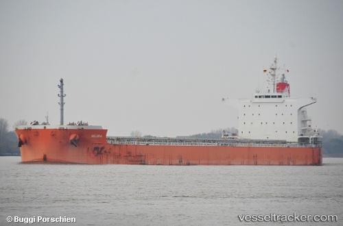
Vessel profile: FIESTA is a Cargo with dimensions m x m.
This page combines live AIS, route history, probable destination signals, nearby traffic, and port activity for practical vessel monitoring.
The current position of vessel FIESTA is -14.80167 lat / 58.41167 lng. Updated: 2026-05-21 01:43:52 UTCNearest reference points:
- Open sea, approx. 401 nm off the nearest listed port
- Open sea, approx. 402 nm off the nearest listed port
- Open sea, approx. 403 nm off the nearest listed port
Currently sailing under the flag of Liberia ![]()
Details:
Live Vessel FIESTA Analytics (details, animations, etc.)
Recent AIS points (UTC):
2026-05-20 22:44:08 UTC · -14.39136, 58.83615 · SOG 11.7 kn · COG 226°2026-05-21 00:22:53 UTC · -14.61167, 58.59833 · SOG 11 kn · COG -1°
2026-05-21 01:23:32 UTC · -14.75425, 58.45702 · SOG 11.6 kn · COG 222°
2026-05-21 01:43:52 UTC · -14.80167, 58.41167 · SOG 11 kn · COG -1°