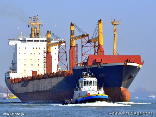
 ARTOTINA
Current Status
Where is the vessel?
ARTOTINA is currently in Near DICT / SVT, based on AIS data received about 15h ago.
Latest AIS update:
Current position: 7.20925° N, 125.65129° E (Near DICT / SVT)
Average speed (last 7 days): Loading…
Average speed (last 30 days): Loading…
Vessel profile: ARTOTINA is a Container Ship with dimensions m x m.
This page combines live AIS, route history, probable destination signals, nearby traffic, and port activity for practical vessel monitoring.
The current position of vessel ARTOTINA is 7.20925 lat / 125.65129 lng. Updated: 2026-05-23 00:02:48 UTCNearest reference points:
- Near DICT / SVT
- Near Taganito
- 48 nm N of Melonguanne
Currently sailing under the flag of Liberia ![]()
Details:
Live Vessel ARTOTINA Analytics (details, animations, etc.)
Recent AIS points (UTC):
2026-05-22 20:05:51 UTC · 7.20923, 125.65131 · SOG 0 kn · COG 233°2026-05-22 22:14:49 UTC · 7.20922, 125.65126 · SOG 0 kn · COG 234°
2026-05-22 22:50:46 UTC · 7.20923, 125.65131 · SOG 0 kn · COG 233°
2026-05-23 00:02:48 UTC · 7.20925, 125.65129 · SOG 0 kn · COG 233°