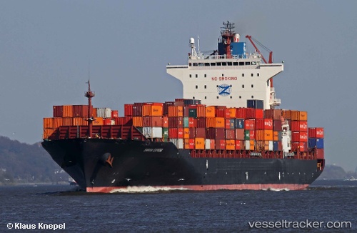
 MSC CONAKRY IV
Current Status
Where is the vessel?
MSC CONAKRY IV is currently in 21 nm SE of ZHOUSHAN, based on AIS data received about 14h ago.
Latest AIS update:
Current position: 29.71066° N, 122.47562° E (21 nm SE of ZHOUSHAN)
Average speed (last 7 days): Loading…
Average speed (last 30 days): Loading…
Vessel profile: MSC CONAKRY IV is a Container Ship with dimensions m x m.
This page combines live AIS, route history, probable destination signals, nearby traffic, and port activity for practical vessel monitoring.
The current position of vessel MSC CONAKRY IV is 29.71066 lat / 122.47562 lng. Updated: 2026-05-22 06:30:23 UTCNearest reference points:
- 24 nm SE of ZHOUSHAN
- 25 nm SE of ZHOUSHAN
- 20 nm SE of ZHOUSHAN
Currently sailing under the flag of Liberia ![]()
Details:
Live Vessel MSC CONAKRY IV Analytics (details, animations, etc.)
Recent AIS points (UTC):
2026-05-22 01:54:15 UTC · 30.11819, 123.02657 · SOG 3.4 kn · COG 226°2026-05-22 03:24:02 UTC · 29.93204, 122.92002 · SOG 8.7 kn · COG 197°
2026-05-22 05:02:42 UTC · 29.72328, 122.76028 · SOG 8.8 kn · COG 230°
2026-05-22 06:30:23 UTC · 29.71066, 122.47562 · SOG 11.7 kn · COG 282°