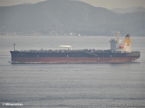
 HIGH NAVIGATOR
Current Status
Where is the vessel?
HIGH NAVIGATOR is currently in 116 nm S of YORK, based on AIS data received about 14h ago.
Latest AIS update:
Current position: 5.63333° N, 12.74167° W (116 nm S of YORK)
Average speed (last 7 days): Loading…
Average speed (last 30 days): Loading…
Vessel profile: HIGH NAVIGATOR is a Tanker with dimensions m x m.
This page combines live AIS, route history, probable destination signals, nearby traffic, and port activity for practical vessel monitoring.
The current position of vessel HIGH NAVIGATOR is 5.63333 lat / -12.74167 lng. Updated: 2026-05-23 01:38:36 UTCNearest reference points:
- 126 nm SW of YORK
- 15 nm SW of Buchanan
- 110 nm SW of River Cess
Currently sailing under the flag of Liberia ![]()
Details:
Live Vessel HIGH NAVIGATOR Analytics (details, animations, etc.)
Recent AIS points (UTC):
2026-05-22 22:35:36 UTC · 5.36167, -12.19333 · SOG 12 kn · COG -1°2026-05-22 23:45:49 UTC · 5.46631, -12.40195 · SOG 12.1 kn · COG 300°
2026-05-23 01:35:35 UTC · 5.62833, -12.73167 · SOG 12 kn · COG -1°
2026-05-23 01:38:36 UTC · 5.63333, -12.74167 · SOG 12 kn · COG -1°