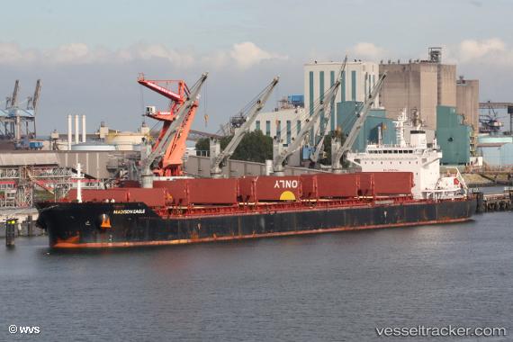
 STAR MADISON
Current Status
Where is the vessel?
STAR MADISON is currently in 106 nm SW of Yetagun Field, based on AIS data received about 14h ago.
Latest AIS update:
Current position: 11.67666° N, 95.70167° E (106 nm SW of Yetagun Field)
Average speed (last 7 days): Loading…
Average speed (last 30 days): Loading…
Vessel profile: STAR MADISON is a Bulk Carrier with dimensions m x m.
This page combines live AIS, route history, probable destination signals, nearby traffic, and port activity for practical vessel monitoring.
The current position of vessel STAR MADISON is 11.67666 lat / 95.70167 lng. Updated: 2026-05-21 20:12:20 UTCNearest reference points:
- 126 nm S of Yetagun Field
- 175 nm W of Ranong Apt
- 84 nm NW of Yetagun Field
Currently sailing under the flag of Liberia ![]()
Details:
Live Vessel STAR MADISON Analytics (details, animations, etc.)
Recent AIS points (UTC):
2026-05-21 16:39:19 UTC · 12.29000, 95.40500 · SOG 11 kn · COG -1°2026-05-21 17:51:20 UTC · 12.08500, 95.50833 · SOG 11 kn · COG -1°
2026-05-21 19:54:19 UTC · 11.72833, 95.67500 · SOG 11 kn · COG -1°
2026-05-21 20:12:20 UTC · 11.67666, 95.70167 · SOG 11 kn · COG -1°