 NIKOS
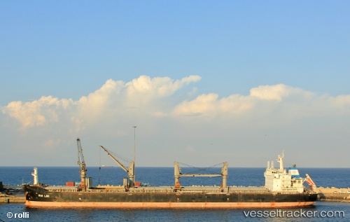
NIKOS
Current Status
Where is the vessel?
NIKOS is currently in 40 nm SW of Keti Bandar, based on AIS data received about 15h ago.
Latest AIS update:
Current position: 23.68456° N, 66.89516° E (40 nm SW of Keti Bandar)
Average speed (last 7 days): Loading…
Average speed (last 30 days): Loading…
Vessel profile: NIKOS is a Bulk Carrier with dimensions m x m.
This page combines live AIS, route history, probable destination signals, nearby traffic, and port activity for practical vessel monitoring.
The current position of vessel NIKOS is 23.68456 lat / 66.89516 lng. Updated: 2026-05-22 05:44:36 UTCNearest reference points:
- 84 nm SW of Keti Bandar
- 16 nm S of Kiamari
- Near Kiamari
Currently sailing under the flag of Liberia ![]()
Details:
Live Vessel NIKOS Analytics (details, animations, etc.)
Recent AIS points (UTC):
2026-05-22 01:19:44 UTC · 23.68142, 66.81214 · SOG 2 kn · COG 155°2026-05-22 04:09:44 UTC · 23.67920, 66.86428 · SOG 0.6 kn · COG 142°
2026-05-22 04:19:24 UTC · 23.67960, 66.86734 · SOG 0.7 kn · COG 145°
2026-05-22 05:44:36 UTC · 23.68456, 66.89516 · SOG 1.1 kn · COG 139°