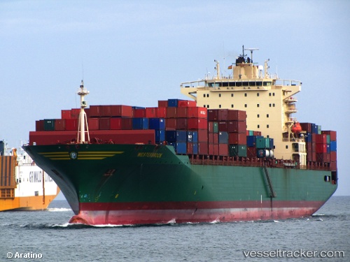
 MSC MIRAYA V
Current Status
Where is the vessel?
MSC MIRAYA V is currently in Near HAMBANTOTA, based on AIS data received about 14h ago.
Latest AIS update:
Current position: 6.07642° N, 81.20023° E (Near HAMBANTOTA)
Average speed (last 7 days): Loading…
Average speed (last 30 days): Loading…
Vessel profile: MSC MIRAYA V is a Container Ship with dimensions m x m.
This page combines live AIS, route history, probable destination signals, nearby traffic, and port activity for practical vessel monitoring.
The current position of vessel MSC MIRAYA V is 6.07642 lat / 81.20023 lng. Updated: 2026-05-23 06:37:09 UTCNearest reference points:
- Near HAMBANTOTA
- 40 nm E of Konwelana
- 42 nm E of Konwelana
Currently sailing under the flag of Liberia ![]()
Details:
Live Vessel MSC MIRAYA V Analytics (details, animations, etc.)
Recent AIS points (UTC):
2026-05-23 02:20:59 UTC · 6.00970, 81.36535 · SOG 1.1 kn · COG 316°2026-05-23 03:22:59 UTC · 6.04947, 81.24333 · SOG 8.7 kn · COG 286°
2026-05-23 05:00:39 UTC · 6.06297, 81.17228 · SOG 1.2 kn · COG 327°
2026-05-23 06:37:09 UTC · 6.07642, 81.20023 · SOG 1.1 kn · COG 319°