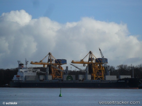
Columbia
Current StatusWhere is the vessel?
Columbia is currently in Near Tubarão Pt./Vitória, based on AIS data received about 14h ago.
Latest AIS update:
Current position: 20.30134° S, 40.18093° W (Near Tubarão Pt./Vitória)
Average speed (last 7 days): Loading…
Average speed (last 30 days): Loading…
Vessel profile: Columbia is a Bulk Carrier with dimensions 32m x 190m.
This page combines live AIS, route history, probable destination signals, nearby traffic, and port activity for practical vessel monitoring.
The current position of vessel Columbia is -20.30134 lat / -40.18093 lng. Updated: 2026-06-06 13:48:19 UTCNearest reference points:
- Near Tubarão Pt./Vitória
- Near JARDIM CAMBURI
- Near BAIA DE VITORIA
Details:
Live Vessel Columbia Analytics (details, animations, etc.)
Recent AIS points (UTC):
2026-06-06 10:03:15 UTC · -20.30118, -40.18058 · SOG 0.3 kn · COG 169°2026-06-06 11:54:14 UTC · -20.30126, -40.18084 · SOG 0.3 kn · COG 165°
2026-06-06 13:09:16 UTC · -20.30131, -40.18099 · SOG 0.2 kn · COG 160°
2026-06-06 13:48:19 UTC · -20.30134, -40.18093 · SOG 0.2 kn · COG 165°