 OKEE GUSTAV
Current Status
Where is the vessel?
OKEE GUSTAV is currently in 59 nm E of Port Eads, based on AIS data received about 15h ago.
Latest AIS update:
Current position: 28.77167° N, 88.06667° W (59 nm E of Port Eads)
Average speed (last 7 days): Loading…
Average speed (last 30 days): Loading…
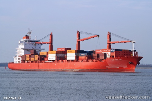
Vessel profile: OKEE GUSTAV is a Container Ship with dimensions 186m x 28m.
This page combines live AIS, route history, probable destination signals, nearby traffic, and port activity for practical vessel monitoring.
The current position of vessel OKEE GUSTAV is 28.77167 lat / -88.06667 lng. Updated: 2026-05-19 16:11:28 UTCNearest reference points:
- 13 nm NE of Pilottown
- Near Pilottown
- Near Bon Secour
Currently sailing under the flag of Liberia ![]()
OKEE GUSTAV built in 2007 year
Deadweight:
28142 tDetails:
Live Vessel OKEE GUSTAV Analytics (details, animations, etc.)
Recent AIS points (UTC):
2026-05-19 13:38:26 UTC · 29.15667, -87.76333 · SOG 17 kn · COG -1°2026-05-19 13:53:30 UTC · 29.09500, -87.79500 · SOG 14 kn · COG -1°
2026-05-19 16:02:30 UTC · 28.78833, -88.04333 · SOG 10 kn · COG -1°
2026-05-19 16:11:28 UTC · 28.77167, -88.06667 · SOG 10 kn · COG -1°