 VIKTOR TSOI
Current Status
Where is the vessel?
VIKTOR TSOI is currently in 19 nm SW of Exspan, based on AIS data received about 14h ago.
Latest AIS update:
Current position: 2.08172° S, 104.99105° E (19 nm SW of Exspan)
Average speed (last 7 days): Loading…
Average speed (last 30 days): Loading…
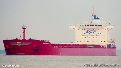
Vessel profile: VIKTOR TSOI is a Bulk Carrier with dimensions m x m.
This page combines live AIS, route history, probable destination signals, nearby traffic, and port activity for practical vessel monitoring.
The current position of vessel VIKTOR TSOI is -2.08172 lat / 104.99105 lng. Updated: 2026-05-20 06:14:52 UTCNearest reference points:
- 36 nm SW of Exspan
- 38 nm SW of PANGKAL BALAM
- Near Kertapati
Currently sailing under the flag of Liberia ![]()
Details:
Live Vessel VIKTOR TSOI Analytics (details, animations, etc.)
Recent AIS points (UTC):
2026-05-20 02:14:45 UTC · -2.08192, 104.99298 · SOG 0.1 kn · COG 202°2026-05-20 03:44:51 UTC · -2.08193, 104.99273 · SOG 0.1 kn · COG 185°
2026-05-20 04:53:49 UTC · -2.08170, 104.99219 · SOG 0 kn · COG 178°
2026-05-20 06:14:52 UTC · -2.08172, 104.99105 · SOG 0.1 kn · COG 157°