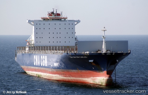
 STRATFORD
Current Status
Where is the vessel?
STRATFORD is currently in 31 nm W of Dighi (Pune), based on AIS data received about 14h ago.
Latest AIS update:
Current position: 18.05539° N, 72.46655° E (31 nm W of Dighi (Pune))
Average speed (last 7 days): Loading…
Average speed (last 30 days): Loading…
Vessel profile: STRATFORD is a Container Ship with dimensions m x m.
This page combines live AIS, route history, probable destination signals, nearby traffic, and port activity for practical vessel monitoring.
The current position of vessel STRATFORD is 18.05539 lat / 72.46655 lng. Updated: 2026-05-22 21:58:35 UTCNearest reference points:
- Near Mumbai
- Near HNB SEZ/Mumbai
- Near NHAVA SHEVA
Currently sailing under the flag of Liberia ![]()
Details:
Live Vessel STRATFORD Analytics (details, animations, etc.)
Recent AIS points (UTC):
2026-05-22 17:35:25 UTC · 18.01095, 72.56089 · SOG 8.3 kn · COG 265°2026-05-22 19:21:36 UTC · 18.03338, 72.45130 · SOG 0.2 kn · COG 247°
2026-05-22 19:48:56 UTC · 18.03611, 72.45247 · SOG 0.5 kn · COG 264°
2026-05-22 21:58:35 UTC · 18.05539, 72.46655 · SOG 0.7 kn · COG 279°