 KARSOY
Current Status
Where is the vessel?
KARSOY is currently in 32 nm W of Komiza, based on AIS data received about 14h ago.
Latest AIS update:
Current position: 43.01455° N, 15.36512° E (32 nm W of Komiza)
Average speed (last 7 days): Loading…
Average speed (last 30 days): Loading…
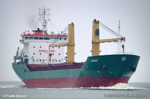
Vessel profile: KARSOY is a General Cargo with dimensions m x m.
This page combines live AIS, route history, probable destination signals, nearby traffic, and port activity for practical vessel monitoring.
The current position of vessel KARSOY is 43.01455 lat / 15.36512 lng. Updated: 2026-05-21 13:10:38 UTCNearest reference points:
- 26 nm N of Isole Tremiti
- Near Primosten
- Near Muna na Zirju
Currently sailing under the flag of Liberia ![]()
Details:
Live Vessel KARSOY Analytics (details, animations, etc.)
Recent AIS points (UTC):
2026-05-21 11:05:39 UTC · 42.73902, 15.68210 · SOG 10.4 kn · COG 318°2026-05-21 11:29:10 UTC · 42.78948, 15.61902 · SOG 10.4 kn · COG 320°
2026-05-21 13:10:38 UTC · 43.01455, 15.36512 · SOG 10.2 kn · COG 321°
2026-05-21 13:10:38 UTC · 43.01455, 15.36512 · SOG 10.2 kn · COG 321°