 vesseltracker.com
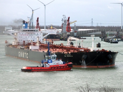
 Al Agaila
Current Status
Where is the vessel?
Al Agaila is currently in 63 nm S of Akrotiri, based on AIS data received about 15h ago.
Latest AIS update:
Current position: 33.56934° N, 32.72770° E (63 nm S of Akrotiri)
Average speed (last 7 days): Loading…
Average speed (last 30 days): Loading…
Vessel profile: Al Agaila is a Crude Oil Tanker with dimensions 274m x 274m.
This page combines live AIS, route history, probable destination signals, nearby traffic, and port activity for practical vessel monitoring.
The current position of vessel Al Agaila is 33.56934 lat / 32.72770 lng. Updated: 2026-05-18 04:11:51 UTCNearest reference points:
- 68 nm SW of Paphos
- 11 nm SE of Paphos
- 31 nm SE of Vasilikos
Currently sailing under the flag of Libya ![]()
Details:
Live Vessel Al Agaila Analytics (details, animations, etc.)
Recent AIS points (UTC):
2026-05-18 02:17:51 UTC · 33.61371, 32.72255 · SOG 1.3 kn · COG 210°2026-05-18 02:19:22 UTC · 33.61316, 32.72255 · SOG 1.3 kn · COG 209°
2026-05-18 03:54:32 UTC · 33.57635, 32.72681 · SOG 1.5 kn · COG 208°
2026-05-18 04:11:51 UTC · 33.56934, 32.72770 · SOG 1.4 kn · COG 214°