 MAVERICK
Current Status
Where is the vessel?
MAVERICK is currently in 52 nm W of Jeddah, based on AIS data received about 16h ago.
Latest AIS update:
Current position: 21.22094° N, 38.25162° E (52 nm W of Jeddah)
Average speed (last 7 days): Loading…
Average speed (last 30 days): Loading…
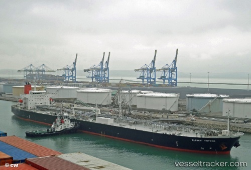
Vessel profile: MAVERICK is a Oil Products Tanker with dimensions m x m.
This page combines live AIS, route history, probable destination signals, nearby traffic, and port activity for practical vessel monitoring.
The current position of vessel MAVERICK is 21.22094 lat / 38.25162 lng. Updated: 2026-05-20 16:08:20 UTCNearest reference points:
- 64 nm W of Tusdeer Free Zone
- 67 nm W of Tusdeer Free Zone
- 10 nm SW of Jeddah
Currently sailing under the flag of Sierra Leone ![]()
Details:
Live Vessel MAVERICK Analytics (details, animations, etc.)
Recent AIS points (UTC):
2026-05-20 13:52:09 UTC · 20.83990, 38.46314 · SOG 11.3 kn · COG 337°2026-05-20 15:54:09 UTC · 21.18102, 38.27493 · SOG 11.3 kn · COG 325°
2026-05-20 16:08:20 UTC · 21.22094, 38.25162 · SOG 11.2 kn · COG 326°
2026-05-20 16:08:20 UTC · 21.22094, 38.25162 · SOG 11.2 kn · COG 326°