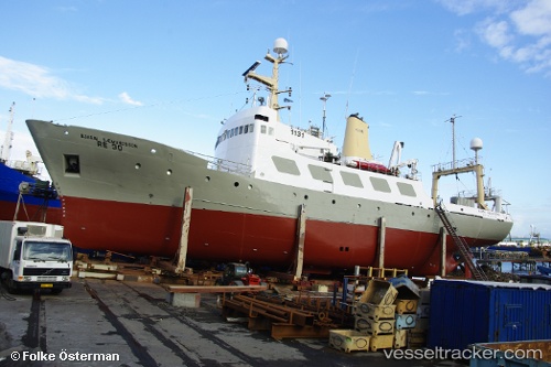
 BJARNI SAEMUNDSSON
Current Status
Where is the vessel?
BJARNI SAEMUNDSSON is currently in Open sea (no nearby ports in database), based on AIS data received about 16h ago.
Latest AIS update:
Current position: 5.43569° N, 23.23639° W (Open sea (no nearby ports in database))
Average speed (last 7 days): Loading…
Average speed (last 30 days): Loading…
Vessel profile: BJARNI SAEMUNDSSON is a Fishery Research Vessel with dimensions m x m.
This page combines live AIS, route history, probable destination signals, nearby traffic, and port activity for practical vessel monitoring.
The current position of vessel BJARNI SAEMUNDSSON is 5.43569 lat / -23.23639 lng. Updated: 2026-05-21 22:59:45 UTCNearest reference points:
- Open sea (no nearby ports in database)
- Open sea, approx. 549 nm off the nearest listed port
- Open sea, approx. 542 nm off the nearest listed port
Currently sailing under the flag of Togo ![]()
Details:
Live Vessel BJARNI SAEMUNDSSON Analytics (details, animations, etc.)
Recent AIS points (UTC):
2026-05-21 19:11:31 UTC · 6.02000, -22.95833 · SOG 10 kn · COG -1°2026-05-21 19:53:31 UTC · 5.90500, -23.01333 · SOG 10 kn · COG -1°
2026-05-21 22:11:03 UTC · 5.55421, -23.18022 · SOG 10.2 kn · COG 207°
2026-05-21 22:59:45 UTC · 5.43569, -23.23639 · SOG 10.3 kn · COG 207°