 Maria
Maria
Current Status
Where is the vessel?
Maria is currently in 107 nm W of Gageohyangri, based on AIS data received about 14h ago.
Latest AIS update:
Current position: 34.57940° N, 123.01282° E (107 nm W of Gageohyangri)
Average speed (last 7 days): Loading…
Average speed (last 30 days): Loading…
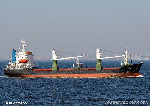
Vessel profile: Maria is a General Cargo Ship with dimensions 111m x 18m.
This page combines live AIS, route history, probable destination signals, nearby traffic, and port activity for practical vessel monitoring.
The current position of vessel Maria is 34.57940 lat / 123.01282 lng. Updated: 2026-05-22 23:58:53 UTCNearest reference points:
- 111 nm W of Gageohyangri
- 102 nm W of Gageohyangri
- 116 nm NE of DAFENG
Currently sailing under the flag of Togo ![]()
Maria built in 1992 year
Deadweight:
6280 tDetails:
Live Vessel Maria Analytics (details, animations, etc.)
Recent AIS points (UTC):
2026-05-22 20:01:16 UTC · 33.85683, 123.04937 · SOG 10.6 kn · COG -1°2026-05-22 22:13:44 UTC · 34.25908, 123.03015 · SOG 11.1 kn · COG -1°
2026-05-22 22:40:13 UTC · 34.33847, 123.02595 · SOG 11.1 kn · COG -1°
2026-05-22 23:58:53 UTC · 34.57940, 123.01282 · SOG 10.5 kn · COG -1°