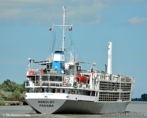
 NABOLSI I
Current Status
Where is the vessel?
NABOLSI I is currently in 33 nm W of Komiza, based on AIS data received about 14h ago.
Latest AIS update:
Current position: 42.97472° N, 15.34658° E (33 nm W of Komiza)
Average speed (last 7 days): Loading…
Average speed (last 30 days): Loading…
Vessel profile: NABOLSI I is a Livestock Carrier with dimensions m x m.
This page combines live AIS, route history, probable destination signals, nearby traffic, and port activity for practical vessel monitoring.
The current position of vessel NABOLSI I is 42.97472 lat / 15.34658 lng. Updated: 2026-05-21 07:43:57 UTCNearest reference points:
- 26 nm N of Isole Tremiti
- Near Primosten
- Near Muna na Zirju
Currently sailing under the flag of Saint Kitts and Nevis ![]()
Details:
Live Vessel NABOLSI I Analytics (details, animations, etc.)
Recent AIS points (UTC):
2026-05-21 04:32:46 UTC · 42.62408, 15.74628 · SOG 8.4 kn · COG -1°2026-05-21 05:55:07 UTC · 42.77853, 15.58244 · SOG 8.7 kn · COG -1°
2026-05-21 07:04:27 UTC · 42.90121, 15.42629 · SOG 8.6 kn · COG -1°
2026-05-21 07:43:57 UTC · 42.97472, 15.34658 · SOG 8.6 kn · COG -1°