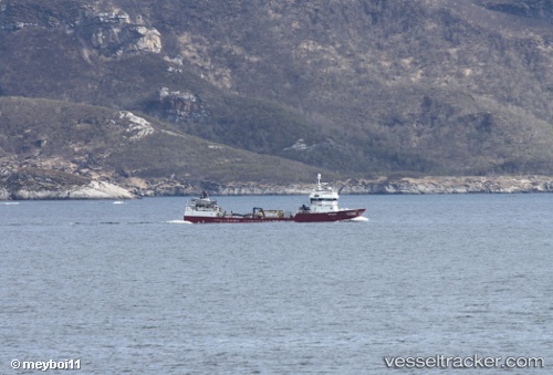
 INTER AUSTRAL
Current Status
Where is the vessel?
INTER AUSTRAL is currently in 15 nm SW of Cochamó, based on AIS data received about 14h ago.
Latest AIS update:
Current position: 41.71908° S, 72.49013° W (15 nm SW of Cochamó)
Average speed (last 7 days): Loading…
Average speed (last 30 days): Loading…
Vessel profile: INTER AUSTRAL is a Fish Carrier with dimensions m x m.
This page combines live AIS, route history, probable destination signals, nearby traffic, and port activity for practical vessel monitoring.
The current position of vessel INTER AUSTRAL is -41.71908 lat / -72.49013 lng. Updated: 2026-05-18 22:38:56 UTCNearest reference points:
- Near Puerto Montt
- Near Chonchi
- Near Quellón (Puerto Quellón)
Details:
Live Vessel INTER AUSTRAL Analytics (details, animations, etc.)
Recent AIS points (UTC):
2026-05-18 19:32:36 UTC · -41.71908, -72.49020 · SOG 0 kn · COG 51°2026-05-18 20:02:14 UTC · -41.71908, -72.49018 · SOG 0 kn · COG 51°
2026-05-18 21:51:16 UTC · -41.71908, -72.49014 · SOG 0 kn · COG 50°
2026-05-18 22:38:56 UTC · -41.71908, -72.49013 · SOG 0.1 kn · COG 54°