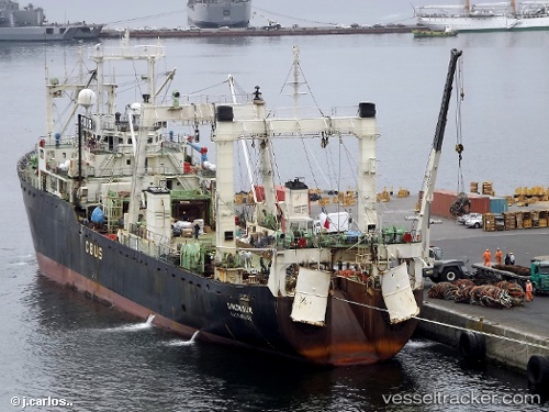
Unionsur
Current StatusWhere is the vessel?
Unionsur is currently in 29 nm E of Cabo de Hornos, based on AIS data received about 15h ago.
Latest AIS update:
Current position: 55.92262° S, 66.32710° W (29 nm E of Cabo de Hornos)
Average speed (last 7 days): Loading…
Average speed (last 30 days): Loading…
Vessel profile: Unionsur is a Fishing Vessel with dimensions 18m x 100m.
This page combines live AIS, route history, probable destination signals, nearby traffic, and port activity for practical vessel monitoring.
The current position of vessel Unionsur is -55.92262 lat / -66.32710 lng. Updated: 2026-05-22 21:27:01 UTCNearest reference points:
- 66 nm E of Puerto Williams
Details:
Live Vessel Unionsur Analytics (details, animations, etc.)
Recent AIS points (UTC):
2026-05-22 18:11:50 UTC · -56.11316, -66.52742 · SOG 4.5 kn · COG 0°2026-05-22 19:14:06 UTC · -56.04950, -66.46197 · SOG 4.1 kn · COG 7°
2026-05-22 19:53:31 UTC · -56.01143, -66.42354 · SOG 4.1 kn · COG 4°
2026-05-22 21:27:01 UTC · -55.92262, -66.32710 · SOG 4 kn · COG 43°