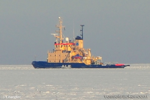
Ale
Current StatusWhere is the vessel?
Ale is currently in Near Lulea, based on AIS data received about 14h ago.
Latest AIS update:
Current position: 65.56970° N, 22.17210° E (Near Lulea)
Average speed (last 7 days): Loading…
Average speed (last 30 days): Loading…
Vessel profile: Ale is a Icebreaker with dimensions 14m x 49m.
This page combines live AIS, route history, probable destination signals, nearby traffic, and port activity for practical vessel monitoring.
The current position of vessel Ale is 65.56970 lat / 22.17210 lng. Updated: 2026-05-20 13:49:59 UTCNearest reference points:
- Near Karlsborg Axelvik
- 20 nm S of HOLMSUND
Details:
Live Vessel Ale Analytics (details, animations, etc.)
Recent AIS points (UTC):
2026-05-20 10:16:58 UTC · 65.56971, 22.17209 · SOG 0 kn · COG 165°2026-05-20 11:34:58 UTC · 65.56971, 22.17210 · SOG 0 kn · COG 165°
2026-05-20 13:01:58 UTC · 65.56971, 22.17209 · SOG 0 kn · COG 165°
2026-05-20 13:49:59 UTC · 65.56970, 22.17210 · SOG 0 kn · COG 164°