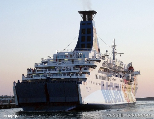
 ELPIS
ELPIS
Current Status
Where is the vessel?
ELPIS is currently in 10 nm NW of Pulau Tikus, based on AIS data received about 14h ago.
Latest AIS update:
Current position: 5.58012° N, 100.22355° E (10 nm NW of Pulau Tikus)
Average speed (last 7 days): Loading…
Average speed (last 30 days): Loading…
Vessel profile: ELPIS is a Ro-Ro/Passenger Ship with dimensions m x m.
This page combines live AIS, route history, probable destination signals, nearby traffic, and port activity for practical vessel monitoring.
The current position of vessel ELPIS is 5.58012 lat / 100.22355 lng. Updated: 2026-05-22 08:29:22 UTCNearest reference points:
- 10 nm NW of Air Itam/Penang
- Near Pulau Tikus
- Near Mak Mandin
Currently sailing under the flag of Comoros ![]()
Details:
Live Vessel ELPIS Analytics (details, animations, etc.)
Recent AIS points (UTC):
2026-05-22 04:21:01 UTC · 5.55134, 100.26249 · SOG 6.5 kn · COG 305°2026-05-22 05:28:51 UTC · 5.59007, 100.18809 · SOG 1.8 kn · COG 300°
2026-05-22 07:42:11 UTC · 5.60970, 100.14785 · SOG 4.1 kn · COG 112°
2026-05-22 08:29:22 UTC · 5.58012, 100.22355 · SOG 6.4 kn · COG 120°