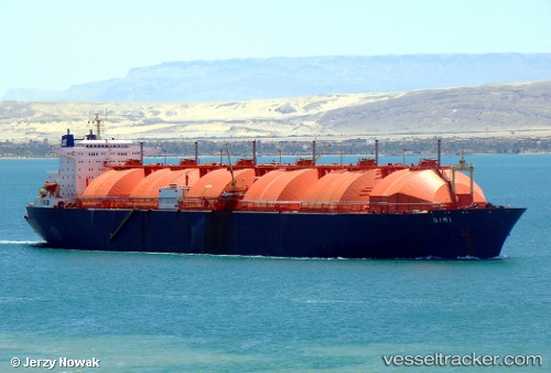
Gimi
Current StatusWhere is the vessel?
Gimi is currently in Near Saint Louis, based on AIS data received about 14h ago.
Latest AIS update:
Current position: 16.06333° N, 16.60333° W (Near Saint Louis)
Average speed (last 7 days): Loading…
Average speed (last 30 days): Loading…
Vessel profile: Gimi is a Lng Tanker with dimensions 42m x 294m.
This page combines live AIS, route history, probable destination signals, nearby traffic, and port activity for practical vessel monitoring.
The current position of vessel Gimi is 16.06333 lat / -16.60333 lng. Updated: 2026-05-19 05:44:50 UTCNearest reference points:
- Near Rufisque
- Near Dakar
- 100 nm NW of Saint Louis
Details:
Live Vessel Gimi Analytics (details, animations, etc.)
Recent AIS points (UTC):
2026-05-19 01:29:26 UTC · 16.06466, -16.60387 · SOG 0 kn · COG 39°2026-05-19 03:41:27 UTC · 16.06469, -16.60385 · SOG 0 kn · COG 39°
2026-05-19 04:56:28 UTC · 16.06467, -16.60385 · SOG 0 kn · COG 39°
2026-05-19 05:44:50 UTC · 16.06333, -16.60333 · SOG 0 kn · COG -1°