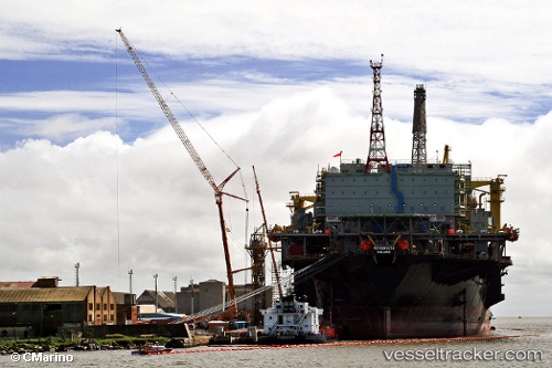
Petrobras 53
Current StatusWhere is the vessel?
Petrobras 53 is currently in 29 nm NE of Fluminense FPSO, based on AIS data received about 14h ago.
Latest AIS update:
Current position: 22.42370° S, 39.96015° W (29 nm NE of Fluminense FPSO)
Average speed (last 7 days): Loading…
Average speed (last 30 days): Loading…
Vessel profile: Petrobras 53 is a Offshore Processing Ship with dimensions 52m x 346m.
This page combines live AIS, route history, probable destination signals, nearby traffic, and port activity for practical vessel monitoring.
The current position of vessel Petrobras 53 is -22.42370 lat / -39.96015 lng. Updated: 2026-05-19 09:13:28 UTCNearest reference points:
- Near Fluminense FPSO
- 68 nm SE of Espírito Santo FPSO
- Near Capixaba FPSO
Details:
Live Vessel Petrobras 53 Analytics (details, animations, etc.)
Recent AIS points (UTC):
2026-05-19 05:22:18 UTC · -22.42240, -39.95947 · SOG 0.1 kn · COG 132°2026-05-19 07:24:12 UTC · -22.42296, -39.95987 · SOG 0 kn · COG 115°
2026-05-19 08:13:40 UTC · -22.42329, -39.96005 · SOG 0 kn · COG 106°
2026-05-19 09:13:28 UTC · -22.42370, -39.96015 · SOG 0 kn · COG 96°