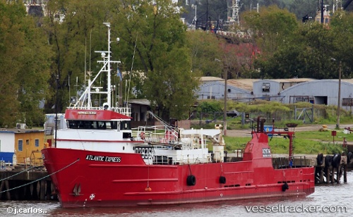
 ATLANTIC EXPRESS
Current Status
Where is the vessel?
ATLANTIC EXPRESS is currently in Near Mar Del Plata, based on AIS data received about 14d ago.
Latest AIS update:
Current position: 38.04628° S, 57.53946° W (Near Mar Del Plata)
Average speed (last 7 days): Loading…
Average speed (last 30 days): Loading…
Vessel profile: ATLANTIC EXPRESS is a Fishing with dimensions m x m.
This page combines live AIS, route history, probable destination signals, nearby traffic, and port activity for practical vessel monitoring.
The current position of vessel ATLANTIC EXPRESS is -38.04628 lat / -57.53946 lng. Updated: 2026-05-08 17:36:12 UTCNearest reference points:
- Near Mar Del Plata
- Near NECOCHEA
- 16 nm N of Cabo San Antonio
Details:
Live Vessel ATLANTIC EXPRESS Analytics (details, animations, etc.)
Recent AIS points (UTC):
2026-05-08 17:36:12 UTC · -38.04628, -57.53946 · SOG 0 kn · COG 262°2026-05-08 17:36:12 UTC · -38.04628, -57.53946 · SOG 0 kn · COG 262°
2026-05-08 17:36:12 UTC · -38.04628, -57.53946 · SOG 0 kn · COG 262°
2026-05-08 17:36:12 UTC · -38.04628, -57.53946 · SOG 0 kn · COG 262°