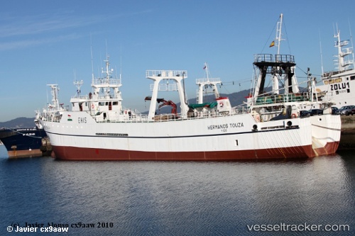
 HERMANOS TOUZA
Current Status
Where is the vessel?
HERMANOS TOUZA is currently in 99 nm W of Las Brujas, based on AIS data received about 16h ago.
Latest AIS update:
Current position: 23.20167° N, 20.05500° W (99 nm W of Las Brujas)
Average speed (last 7 days): Loading…
Average speed (last 30 days): Loading…
Vessel profile: HERMANOS TOUZA is a Fishing Vessel with dimensions 10m x 74m.
This page combines live AIS, route history, probable destination signals, nearby traffic, and port activity for practical vessel monitoring.
The current position of vessel HERMANOS TOUZA is 23.20167 lat / -20.05500 lng. Updated: 2026-05-21 22:08:31 UTCCurrently sailing under the flag of Falkland Islands ![]()
HERMANOS TOUZA built in 1986 year
Deadweight:
943 tDetails:
Live Vessel HERMANOS TOUZA Analytics (details, animations, etc.)
Recent AIS points (UTC):
2026-05-21 17:41:33 UTC · 22.43333, -20.44500 · SOG 11 kn · COG -1°2026-05-21 19:08:34 UTC · 22.68167, -20.31833 · SOG 11 kn · COG -1°
2026-05-21 19:50:34 UTC · 22.80167, -20.25667 · SOG 11 kn · COG -1°
2026-05-21 22:08:31 UTC · 23.20167, -20.05500 · SOG 11 kn · COG -1°