 vesseltracker.com
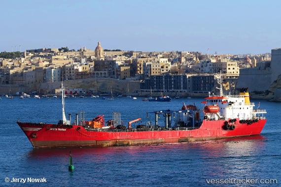
 Santa Maria
Current Status
Where is the vessel?
Santa Maria is currently in Near Il-Kappara, based on AIS data received about 14h ago.
Latest AIS update:
Current position: 35.87289° N, 14.76436° E (Near Il-Kappara)
Average speed (last 7 days): Loading…
Average speed (last 30 days): Loading…
Vessel profile: Santa Maria is a Oil Products Tanker with dimensions 93m x 14m.
This page combines live AIS, route history, probable destination signals, nearby traffic, and port activity for practical vessel monitoring.
The current position of vessel Santa Maria is 35.87289 lat / 14.76436 lng. Updated: 2026-05-18 09:45:46 UTCNearest reference points:
- 13 nm E of Il-Kappara
- 18 nm E of Il-Kappara
- Near Xghajra
Currently sailing under the flag of Malta ![]()
Santa Maria built in 1977 year
Deadweight:
4501 tDetails:
Live Vessel Santa Maria Analytics (details, animations, etc.)
Recent AIS points (UTC):
2026-05-18 05:32:58 UTC · 35.85842, 14.75220 · SOG 0 kn · COG 249°2026-05-18 06:21:12 UTC · 35.87154, 14.76459 · SOG 1.5 kn · COG 313°
2026-05-18 06:21:12 UTC · 35.87154, 14.76459 · SOG 1.5 kn · COG 313°
2026-05-18 09:45:46 UTC · 35.87289, 14.76436 · SOG 0.1 kn · COG -1°