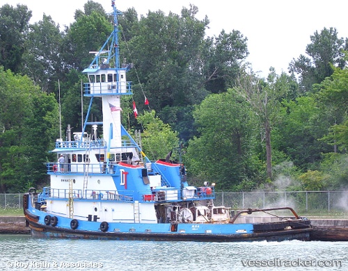
 Allie B
Current Status
Where is the vessel?
Allie B is currently in Near SPARROWS POINT, based on AIS data received about 15h ago.
Latest AIS update:
Current position: 39.20246° N, 76.51141° W (Near SPARROWS POINT)
Average speed (last 7 days): Loading…
Average speed (last 30 days): Loading…
Vessel profile: Allie B is a Tug with dimensions 35m x 35m.
This page combines live AIS, route history, probable destination signals, nearby traffic, and port activity for practical vessel monitoring.
The current position of vessel Allie B is 39.20246 lat / -76.51141 lng. Updated: 2026-05-21 16:20:04 UTCNearest reference points:
- Near DUNDALK
- Near Arundel Village
- Near Curtis Bay, Baltimore
Currently sailing under the flag of USA ![]()
Allie B built in 1977 year
Details:
Live Vessel Allie B Analytics (details, animations, etc.)
Recent AIS points (UTC):
2026-05-21 13:39:41 UTC · 38.90564, -76.40869 · SOG 8 kn · COG 8°2026-05-21 13:55:58 UTC · 38.94181, -76.40165 · SOG 8.1 kn · COG 14°
2026-05-21 16:19:31 UTC · 39.20231, -76.51004 · SOG 6.8 kn · COG 279°
2026-05-21 16:20:04 UTC · 39.20246, -76.51141 · SOG 6.8 kn · COG 267°