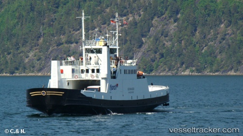
 Geiranger
Current Status
Where is the vessel?
Geiranger is currently in Near Standal, based on AIS data received about 14h ago.
Latest AIS update:
Current position: 62.21128° N, 6.47658° E (Near Standal)
Average speed (last 7 days): Loading…
Average speed (last 30 days): Loading…
Vessel profile: Geiranger is a Passenger Ro Ro Cargo Ship with dimensions 64m x 12m.
This page combines live AIS, route history, probable destination signals, nearby traffic, and port activity for practical vessel monitoring.
The current position of vessel Geiranger is 62.21128 lat / 6.47658 lng. Updated: 2026-05-21 20:13:04 UTCNearest reference points:
- Near Fiskarstrand
- Near SPJELKAVIK
- Near Alesund
Currently sailing under the flag of Norway ![]()
Details:
Live Vessel Geiranger Analytics (details, animations, etc.)
Recent AIS points (UTC):
2026-05-21 17:06:47 UTC · 62.21125, 6.47668 · SOG 0 kn · COG 232°2026-05-21 18:07:31 UTC · 62.20676, 6.51168 · SOG 10.5 kn · COG 107°
2026-05-21 19:54:43 UTC · 62.21127, 6.47670 · SOG 0 kn · COG 232°
2026-05-21 20:13:04 UTC · 62.21128, 6.47658 · SOG 0 kn · COG 232°