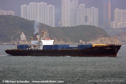
Formosa Container 2
Current StatusWhere is the vessel?
Formosa Container 2 is currently in 99 nm SE of Port Saint John's, based on AIS data received about 14d ago.
Latest AIS update:
Current position: 32.72406° S, 30.99399° E (99 nm SE of Port Saint John's)
Average speed (last 7 days): Loading…
Average speed (last 30 days): Loading…
Vessel profile: Formosa Container 2 is a Container Ship with dimensions 28m x 198m.
This page combines live AIS, route history, probable destination signals, nearby traffic, and port activity for practical vessel monitoring.
The current position of vessel Formosa Container 2 is -32.72406 lat / 30.99399 lng. Updated: 2026-05-04 12:15:07 UTCNearest reference points:
- 125 nm SE of Port Edward
- 23 nm E of Port Saint John's
Details:
Live Vessel Formosa Container 2 Analytics (details, animations, etc.)
Recent AIS points (UTC):
2026-05-04 12:15:07 UTC · -32.72406, 30.99399 · SOG 12.1 kn · COG 67°2026-05-04 12:15:07 UTC · -32.72406, 30.99399 · SOG 12.1 kn · COG 67°
2026-05-04 12:15:07 UTC · -32.72406, 30.99399 · SOG 12.1 kn · COG 67°
2026-05-04 12:15:07 UTC · -32.72406, 30.99399 · SOG 12.1 kn · COG 67°