 Bru 12 Wolfert.frank
Current Status
Where is the vessel?
Bru 12 Wolfert.frank is currently in Near Kornwerderzand, based on AIS data received about 14h ago.
Latest AIS update:
Current position: 53.13112° N, 5.14223° E (Near Kornwerderzand)
Average speed (last 7 days): Loading…
Average speed (last 30 days): Loading…
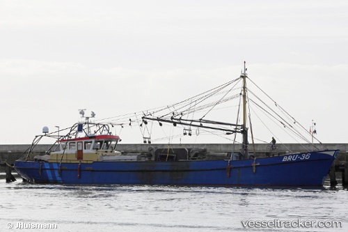
Vessel profile: Bru 12 Wolfert.frank is a Fishing Vessel with dimensions 36m x 7m.
This page combines live AIS, route history, probable destination signals, nearby traffic, and port activity for practical vessel monitoring.
The current position of vessel Bru 12 Wolfert.frank is 53.13112 lat / 5.14223 lng. Updated: 2026-05-19 01:50:51 UTCNearest reference points:
- Near DEN OEVER
- Near MARINA DEN OEVER
- Near OUDESCHILD
Currently sailing under the flag of Netherlands ![]()
Details:
Live Vessel Bru 12 Wolfert.frank Analytics (details, animations, etc.)
Recent AIS points (UTC):
2026-05-18 23:01:02 UTC · 53.13086, 5.14193 · SOG 0.1 kn · COG 90°2026-05-19 00:07:00 UTC · 53.13096, 5.14201 · SOG 0.1 kn · COG 106°
2026-05-19 01:21:50 UTC · 53.13107, 5.14217 · SOG 0 kn · COG 126°
2026-05-19 01:50:51 UTC · 53.13112, 5.14223 · SOG 0.1 kn · COG 140°