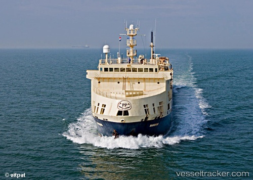
Margiris
Current StatusWhere is the vessel?
Margiris is currently in Near Las Palmas, based on AIS data received about 14h ago.
Latest AIS update:
Current position: 28.14204° N, 15.42145° W (Near Las Palmas)
Average speed (last 7 days): Loading…
Average speed (last 30 days): Loading…
Vessel profile: Margiris is a Fish Carrier with dimensions 17m x 143m.
This page combines live AIS, route history, probable destination signals, nearby traffic, and port activity for practical vessel monitoring.
The current position of vessel Margiris is 28.14204 lat / -15.42145 lng. Updated: 2026-05-18 19:57:43 UTCNearest reference points:
- Near Las Palmas
- Near Las Palmas de Gran Canaria
- Near TALIARTE
Details:
Live Vessel Margiris Analytics (details, animations, etc.)
Recent AIS points (UTC):
2026-05-18 16:21:43 UTC · 28.14203, -15.42142 · SOG 0 kn · COG 179°2026-05-18 17:57:42 UTC · 28.14202, -15.42134 · SOG 0 kn · COG 179°
2026-05-18 19:39:46 UTC · 28.14206, -15.42138 · SOG 0 kn · COG 179°
2026-05-18 19:57:43 UTC · 28.14204, -15.42145 · SOG 0 kn · COG 179°