 LODBROG
Current Status
Where is the vessel?
LODBROG is currently in Near LAUTOKA, based on AIS data received about 14h ago.
Latest AIS update:
Current position: 17.60611° S, 177.42230° E (Near LAUTOKA)
Average speed (last 7 days): Loading…
Average speed (last 30 days): Loading…
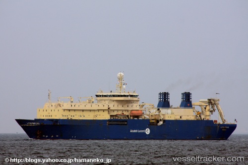
Vessel profile: LODBROG is a Cable Layer with dimensions m x m.
This page combines live AIS, route history, probable destination signals, nearby traffic, and port activity for practical vessel monitoring.
The current position of vessel LODBROG is -17.60611 lat / 177.42230 lng. Updated: 2026-05-18 18:16:25 UTCNearest reference points:
- Near Denarau
- Near DENARAU
- Near Suva
Currently sailing under the flag of France ![]()
Details:
Live Vessel LODBROG Analytics (details, animations, etc.)
Recent AIS points (UTC):
2026-05-18 13:52:24 UTC · -17.60603, 177.42230 · SOG 0.1 kn · COG 204°2026-05-18 15:49:27 UTC · -17.60602, 177.42223 · SOG 0.1 kn · COG 192°
2026-05-18 17:04:28 UTC · -17.60624, 177.42245 · SOG 0.1 kn · COG 224°
2026-05-18 18:16:25 UTC · -17.60611, 177.42230 · SOG 0.1 kn · COG 207°