 vesseltracker.com
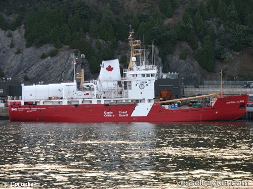
 Martha L. Black
Current Status
Where is the vessel?
Martha L. Black is currently in Near Neuville, based on AIS data received about 14h ago.
Latest AIS update:
Current position: 46.70257° N, 71.52459° W (Near Neuville)
Average speed (last 7 days): Loading…
Average speed (last 30 days): Loading…
Vessel profile: Martha L. Black is a Buoy Lighthouse Vessel with dimensions 83m x 16m.
This page combines live AIS, route history, probable destination signals, nearby traffic, and port activity for practical vessel monitoring.
The current position of vessel Martha L. Black is 46.70257 lat / -71.52459 lng. Updated: 2026-05-18 04:41:09 UTCNearest reference points:
- Near QUEBEC
- Near Cap-de-la-Madeleine
- Near Ile Aux Coudres
Currently sailing under the flag of Canada ![]()
Martha L. Black built in 1986 year
Deadweight:
1688 tDetails:
Live Vessel Martha L. Black Analytics (details, animations, etc.)
Recent AIS points (UTC):
2026-05-18 01:20:02 UTC · 46.70182, -71.52532 · SOG 0.1 kn · COG 279°2026-05-18 02:17:03 UTC · 46.70245, -71.52449 · SOG 0 kn · COG 259°
2026-05-18 04:23:09 UTC · 46.70256, -71.52459 · SOG 0 kn · COG 255°
2026-05-18 04:41:09 UTC · 46.70257, -71.52459 · SOG 0 kn · COG 253°